For earlier paintings, click on these years: 2003 2004 2005-6 2007 2008 2009 2010 2011 2012.
Click on each small image to bring up a larger version. The originals measure 12 x 19 inches (painted area).
The photographs are made with a hand-held camera, and often require straightening and cropping for images that accurately represent the original paintings. I also make simple adjustments of intensity, contrast, saturation and warmth, so that on my monitor the colors resemble the origina paintings to the extent possible. Hopefully they will also be somewhat accurate on your monitor. As for printed copy, nothing whatever can be guaranteed! Beyond these simple corrections, the photos are not retouched.
In some cases, when I refer to a picture as "plein-air," it means that the water was painted on site, but some of the surrounding foliage, rocks, etc., may have been painted later, back in Boulder.
Everything is always evolving. This year the colors seem more muted.
The first eight paintings are of the Arkansas River, from the west bank, looking east. The river flows from left (north) to right (south).
We begin with three paintings of a rapid that I have done several times before. (For some further paintings of this rapid, see 2009 or 2009 or 2010 or 2011 (very high water) or 2012 (low water).) The first was done on a partly rainy day. Morning draft on-site was not saved; in the afternoon I began over indoors, using the morning draft as a guide, along with the two-inch viewing screen on my camera. Result very blue. The next two were painted plein-air on subsequent sunny mornings. Just before the water drops, lots of rock color comes through in the strong sunshine. Number three apparently has a viewpoint very close to the water, which makes the bushes loom big and dark.
In the foreground to the right of the main standing wave, there is a sort of triangle of choppy water, really caused by some rocks lurking below. I saw a raft with six or eight people get stuck on this triangle of rocks. Luckily they were able to rock it back and forth till they got free.
Now one plein-air shot of a pool or rapid that I also did a year ago. It's easy to compare this year's picture (2013) with this one from 2012, to see how much lower the river was a year ago. Also see this one from a year ago.
The next rapid seems to be new for this year. (I haven't identified it among earlier paintings.) Here the rapid has two channels: A shallow slow pool gliding downstream, and a deeper, faster channel with lots of turbulence. Morning (unfinished) and afternoon, on the same day.
There is a place where the canyon narrows and deepens, and where the summer sun at evening lights the east wall, and the water, with warm colors. For some earlier paintings of this phenomenon, see 2012 and 2011 and 2011. Here are two views from this location. The first was actually painted in light rain, and doesn't really show the fire. The second was painted plein-air, another day, in full sun.
Driving west from BV, up toward Cottonwood Lake, there is good access, at about 9,000 feet of elevation, to Cottonwood Creek. It is flowing down from the pass through forested terrain. Until three years ago, there was a substantial beaver dam at this spot, with a pond and lodge for the beavers. That dam burst a couple of years ago; our first take here shows some log piles as remnants of the dam. Our second take, from about a half-mile downstream, shows a log across the creek. Whether positioned by beavers, or just by the elements, I don't know.

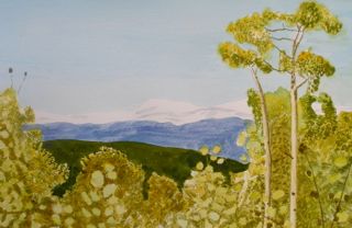
The floods in Boulder, September 12-15, caused roads to be closed, and there was no ready access to aspens, such as I painted around Gold Hill in other years. I did find access to high country up Golden Gate Canyon Road out of Golden, Colorado. Went up there on September 25, and found very few aspen fully turned, but some about half turned, as in this picture. Here they frame the Arapaho Peaks, which lie above Boulder and provide its water.
This site is far enough to be impractical for painting plein-air.